This gazetteer has been developed by Dennis White, Michael Gaffney and Chris Fleet as a means of exploring and presenting historical place names of the Old Parish of Lesmahagow over time. We would be very grateful to hear of comments and corrections ie. Dennis White ( dwhite@scotgenes.com - data and sources), Michael Gaffney - Excel Macros) or Chris Fleet ( c.fleet@nls.uk - maps / website ).
Please consult the following sections for more information:
Acknowledgements
|
1. Introduction
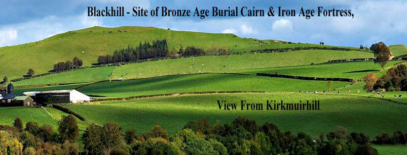
i. The Old Parish of Lesmahagow
The rich history of the Parish is well established elsewhere and users who wish to know more about all aspects of it would be well advised to read the ‘Annals of the Parish of Lesmahagow’ (1864) by John Blackwood Greenshields (available online on the Internet Archive website and at Lanark and Lesmahagow Libraries and Lesmahagow Parish Historical Association).
The history of the old Parish of Lesmahagow is a long and varied one, and there are Old Church records of place names going back as far as the 12th century. The area covered by this database (about 65 square miles) is still a rural one and includes many farms that have been present, at least in name, for hundreds of years. Descendants of many of the families who lived in them still live in the area today. Indeed, it can be said that the old parish of Lesmahagow is a living history! (for example, read Thomson’s poem on ‘Lesmahagow Inhabitants of Fifty Years ago’ (1864), (PDF, 246 Kb).
ii. Background to the development of the database
Dennis White has always been fascinated by local history and place names. In his capacity of genealogist, he first discovered the richness of the old place names in Lesmahagow, both in terms of linguistics and historical significance. He therefore felt compelled to bring this data together and make it available to all. He created an Excel spreadsheet containing all the place names. Then he had the idea of linking each place name to the relevant section of a modern map and to present the data in two ways.
Mike Gaffney, an Excel expert, took these ideas on board and developed macros within Excel to bring Dennis’s ideas to fruition. This created the working concept that allowed Chris Fleet of the National Library of Scotland to develop it further and integrate the database into this website.
iii. The Database
The 4,000 records in this database were extracted from a wide range of historical records and maps. The spelling of many place names has varied greatly across the different sources, over time, as words were written as they sounded to the writer. These records equate to 600 unique place names in the old parish of Lesmahagow. Many of these names stretch so far back in time that they include Gaelic, Brythonic (old British), as well as Scots and English names.
There are three ways to view the place names:
| (a) by Alphabetical order |
| (b) by ‘Unique’ name, |
| (c) by a Filter Place Names/text search box |
The Unique name order shows the records for a particular place name together as a group, regardless of the way they were spelled on the original records. This can show how the ‘shape’ of a place name has changed over the last thousand years. It also allows the quaint spellings of the past to be identified with modern place names.
The Filter Place Names/text search box allows you to search for any text string or name, ie. 'abbey', 'gill', 'green', 'roy', or 'wood'. The list of names below contracts to show just those rows including the text string in the box, and the cells in the table that contain this text string are highlighted with a beige background. You can delete back over the characters in the Filter search box to search on another text string.
iv. The maps (& satellite view)
The default background map is a set of scales of mapping from around 1900 (ie. about a century ago), from 1:1 million in scale, through to the six-inch to the mile / 1:10,560 scale ( Read further information). When you click on a place name in the gazetteer listings, the map will position at approximately this location. Please note that the place name locations are only accurate to the nearest kilometre, so you may need to pan the map sideways to discover the name. Please bear in mind that some of the names will only be on other layers of mapping (so you may need to change the background layer to see the name) and some may not be present on any mapping at all.
There are a number of ways of exploring the location of the place names with the mapping:
| 1. View the parish of Lesmahagow at different points in time |
| 2. View a selection of any map on the list |
| 3. Zoom in and out and pan the mapping sideways |
| 4. In the case of the ‘OS 1:1 million to 6 inch, 1900s (4 layers)’, zoom in to see a further three more detailed scales of mapping at the same time period. The particular scale displayed is written on the lower left of the map. |
v. The Purpose of the database
This facility will allow researchers of family history, local history, place name and linguistic studies to access data that may not be otherwise readily available. Also, it allows others (local or otherwise) who have connections with the area to have a greater insight into its development over the centuries.
2. Abbreviations and Sources
Source of ancient place names:
| Kelso Lib, Assumption, Richens & RMS = All seen in the Journal of Scottish Name Studies Vol 3, 2009 |
Frequently used abbreviations:
| MI = Monumental Inscriptions (from gravestones) |
| OPR = Old Parish Records (church-recorded births, marriages and deaths) |
| JPM = JP Millar’s 1931/2 ‘Series (of articles) for the Hamilton Advertiser’ |
Main List – in Order of year of the source documents shown below:
| Page 76 | 1180 Kel. Lib | Journal of Scottish Name Studies Vol 3 |
| - | 1556 SPNS | Scottish Place Name Society – see source of Kel Lib above. |
| - | 1567 JPM | JP Millar’s 1931/2 Series for the Hamilton Advertiser (available for viewing at Lanark Library) |
| - | 1610 Speed's Map | 1610 Speed’s Map (view online – National Library of Scotland, Edinburgh) |
| - | 1654 Blaeu's Map | 1654 Blaeu’s Map (view online – National Library of Scotland, Edinburgh) |
| Page 87 | 1666 Annals | Annals of The Parish of Lesmahagow, J B Greenshields 1864 (available online or for viewing at Lesmahagow Parish Historical Society or Public Libraries Lesmahagow and Lanark) |
| Page 316 | 1679 Pre 1855 MI | Upper Ward of Lanarkshire Monumental Inscriptions (Pre 1855) (available for viewing at Lesmahagow Parish Historical Society or Lanark Public Library) |
| - | 1686 Adair's map | 1686 Adair’s Map (view online – National Library of Scotland, Edinburgh) |
| 10/10/49 | 1694 OPR Births | Miscellaneous Prints from Scotland’s People/eg. GRO Reference (OPR Births) (available online at http://www.scotlandspeople.gov.uk/.) |
| 649/30/114 | 1748 OPR Marr | Miscellaneous Prints from Scotland’s People/eg. GRO Reference (OPR Marriages) (available online at http://www.scotlandspeople.gov.uk/.) |
| - | 1750s Roy's Map | General William Roy’s Map 1747-1755 (see 'Roy Lowlands - 1752-55' map link on the main page of this website - or view online – National Library of Scotland, Edinburgh ) |
| - | 1773 Ross's Map | 1773 Ross’s Map (view online – National Library of Scotland, Edinburgh) |
| - | 1783 Census | Rev Thomas Linning’s List of Inhabitants/Quarter Number (East of Nethan only) (available for viewing at Lesmahagow Parish Historical Society) |
| P424 | 1790s Old Stat Acc | Old Statistical Account 1791-1799 (available at http://stat-acc-scot.edina.ac.uk/sas/ or main public libraries) |
| - | 1808 Plan RHP195 | Plan of Division of Broken Cross Muir (c1808) (1) (available National Records of Scotland, Edinburgh) |
| - | 1808 Plan | Plan of Broken Cross Muir (2) (available National Records of Scotland, Edinburgh) |
| RHP22022 | 1809 National Records of Scotland | Miscellaneous record re Nether Fauldhouse (available National Records of Scotland, Edinburgh) |
| - | 1816 Forrest's Map | 1816 Forrest’s Map (see main map page on this website or view online – National Library of Scotland, Edinburgh) |
| - | 1821 Ainslie's Map | 1821 Ainslie’s Map (view online – National Library of Scotland, Edinburgh) |
| Q5/445 | 1821 Census | 1821 Census for Lesmahagow Parish (available for viewing at Lesmahagow Parish Historical Society) |
| - | 1822 Thomson's Map | 1822 Thomson’s Map (view online – National Library of Scotland, Edinburgh) |
| RHP168 | 1826 National Records of Scotland | Plan of New Road from Glasgow to Carlisle (Carlisle Road) (available National Records of Scotland, Edinburgh) |
| P30 | 1834 Stat Acc | New Statistical Account of Scotland 1834-45 (Lesmahagow 1834) (available at http://stat-acc-scot.edina.ac.uk/ or main public libraries) |
| RHP10837 | 1842 National Records of Scotland | Miscellaneous NRS record re Knocken (available National Records of Scotland, Edinburgh) |
| P99 | 1858 Val Roll | Valuation Rolls (available National Records of Scotland, Edinburgh) |
| - | 1859 OS 6" Map | 1859 Ordnance Survey 6” Map (view map on the main page of this website) |
| RHP11420 | 1859 National Records of Scotland | Miscellaneous Plan held by NRS re Woods Farm (available National Records of Scotland, Edinburgh) |
| ID46499 RCAHM | 1864 Upper Ward | RCAHM Ref, from ‘Upper Ward of Lanarkshire’ – by G Irvine & A Murray 1864 (available at RCAHMS via http://www.rcahms.gov.uk or Lanark Public Library) |
| P248 | 1864 Upper Ward | From ‘Upper Ward of Lanarkshire’ – by G Irvine & A Murray 1864 (available for viewing at Lanark Public Library) |
| Pages 5-8 | 1864 Thomson’s Poem | ‘Lesmahagow Inhabitants of Fifty Years ago’, by Thomas Thomson, Ohio, published 1914. |
| P220 | 1870 Landowners Dir | (available at Lanark Public Library) |
| T-SA6/1/13 | 1873 Sasines | Sasine Abridgements 1873 – Lanark (3526) (available National Records of Scotland, Edinburgh) |
| ED11 | 1881 Census | Extracted from LDS - Enumeration District Number (available online at http://www.scotlandspeople.gov.uk/.) |
| 79/42 | 1891 Census | Miscellaneous Census record re Thomson family of Kirkmuirhill (Enumeration district Number - (available online at http://www.scotlandspeople.gov.uk/.) |
| Pages 216/7 | 1891 Valuation Roll | Lanark/Lesmahagow (available from Lanark Public Library) |
| - | 1890s OS Map | Miscellaneous Census records re place in Blackwood/Kirkmuirhill (see map link on the main page of this website) |
| - | 1896 Rent Roll | Blackwood Estate Rent Roll – Terms Pendicles & Gardens available for viewing at Lesmahagow Parish Historical Society |
| Appendix 3 | 1900/10 Rent Rolls | Blackwood Estate (available from Lesmahagow Parish Historical Society) |
| 79/42 | 1909 Sasine | Miscellaneous Sasine record re John Thomson (Smith in Kirkmuirhill) (available online at the National Records of Scotland) |
| - | 1900s OS Map | Selection of Miscellaneous Places (see map link on the main page of this website) |
| - | 1926 Internet Ref | Re Hill, Hillside, Bankhead & Middleholm (available via John Zawadzki (2008)) |
| 82/35 | 1976 OS 1:50,000 Map 71 | Main reference map1 used in project for obtaining current NS grid reference (available at National Library of Scotland, Edinburgh) |
| 82/46 | 2001 Explorer Map 343 | Main reference map2 used in project for obtaining current NS grid reference (available at National Library of Scotland, Edinburgh) |
| 82/46 | 2002 OS Landranger Map 72 | Main reference map3 used in project for obtaining current NS grid reference (available at National Library of Scotland, Edinburgh) |
| ID 274191 | 2004 RCAHMS | Miscellaneous RCAHMS record re Birkhill Park (available at RCAHMS via http://www.rcahms.gov.uk) |
3. Place Names where the location is not known or uncertain
| Place Name | Grid/Area Reference | Source of Data | Remarks |
| Arberbray | P14 | 1609 JPM Retours | & Arberbrae 1643 - same sources |
| Archmilne | P14 | 1649 JPM Retours | |
| Auchlogan | T-SA/6/1/13 | 1873 Sasines | Auchlochan? Or Logan? |
| Auchmill | T-SA/6/1/13 | 1873 Sasines | |
| Auchnacro | P20 | 1625 JPM Retours | Achnatroch? |
| Auldhame | P12 | 1649 JPM Retours | |
| Bairns | - | Blaeu’s Map | nr Stonebyres? |
| Baittanes | P302 | 1626 JPM | Beatons? |
| Beillaw | T-SA/6/1/13 | 1873 Sasines | |
| Belleville | P313 | 1894 Pre 1855 MI | |
| Belsteds | - | Blaeu’s Map | nr Blackhill? |
| Blacktoun | - | 1654 Blaeu's Map | Nr Yonderton? |
| Blairbank | T-SA/6/1/13 | 1873 Sasines | At Blair? |
| Burnhouses | 649/10/174 | 1733 OPR Births | Nr Boghead? |
| Burtonfield | P302 | 1787 Pre 1855 MI | |
| Clayrigs | T-SA/6/1/13 | 1873 Sasines | |
| Cluthenbeg | 649/10/213 | 1739 OPR Marr | |
| Coarhouseknow | P321 | 1836 Pre 1855 MI | At Corehouse? |
| Corsford | T-SA/6/1/13 | 1873 Sasines | Crossford? |
| Cowmyres | T-SA/6/1/13 | 1873 Sasines | |
| Cragbank | - | Blaeu’s Map | Craigbank? At River Nethan? |
| Drumassie | P331 | 1905 Pre 1855 MI | Crossford? |
| Gallowhill | T-SA/6/1/13 | 1873 Sasines | |
| Gallowrig | T-SA/6/1/13 | 1873 Sasines | Gallrig? |
| Grafhill | - | Blaeu’s Map | nr Hawksland/Birkhill |
| Graysaughs | 649/10/215 | 1749 OPR Births | |
| Greenhill | Blaeu’s Map | nr Draffan? | |
| Hermitland | T-SA/6/1/13 | 1873 Sasines | |
| Hosnet | P323 | 1821 Pre 1855 MI | |
| Ines | - | Blaeu’s Map | nr Kirkfield? |
| Kersegill | P302 | 1884 Pre 1855 MI | |
| Kickingheuch | - | Blaeu’ Map | nr Borlandhill/Auchmedden? |
| Kreddes | - | Blaeu’s Map | nr Hawksland? |
| Leidtries | T-SA/6/1/13 | 1873 Sasines | |
| Mon | - | Blaeu’s Map | nr Hawksland? |
| Niviland | T-SA/6/1/13 | 1873 Sasines | Near the Kerse? |
| Over Auchinleck | T-SA/6/1/13 | 1873 Sasines | Probably near Nether Affleck |
| Priepswood | - | Blaeu’s Map | Lesmahagoe area – nr Milton? |
| Redeinghouse | 649/10/213 | 1739 OPR Marr | nr blackwood? |
| Spittel | - | Blaeu’s Map | nr Kerse? |
| Staincroft | T-SA/6/1/13 | 1873 Sasines | Nr Garlewood? |
| Struthers | T-SA/6/1/13 | 1873 Sasines | |
| Windy Birkwood | 649/10/207 | 1738 OPR Births |
4. Some Examples of Gaelic Place Names in Lesmahagow Parish
It is not generally realised that, a thousand years ago, Gaelic was spoken in the south of Scotland. Examples of Scottish Gaelic Place Names in the old Parish of Lesmahow are:
| Affleck (achadh+an+leac) | field or farm of the (flat) stones or stone slabs |
| Ardoch (ard+ach) | high place |
| Auchenheath (achadh+an+ath) | field of the ford |
| Auchlochan (achadh+lochan) | field of a lochan |
| Auchnotroch (achadh+an+otrach) | field of the dungheap |
| Auchren (achadh+earrann) | field of a share (of land) |
| Auchtyfardle (achadh+old Scots fardel) | an eighth part (Gaelic) plus a fourth part (Old Scots) of land |
| Auchtygemmell (achadh+personal name Gammell) | Gemmell’s eighth (part of land) |
| Backreckning (blar+raithmeach) | bracken field or muir |
| Cumber (comar) | junction of a watercourse |
| Devon (domhain) | Devon; deep, low lying place, place lying in a hollow |
| Garngour (carn+gobhar) | goat cairn |
| Letham (leathan) | broad slope |
| Logan (lagan) | little hollow |
5. Meanings and Origins of Lesmahagow Place Names (including more Gaelic names)
For an in-depth, academic study of this subject, please read Simon Taylor (2009), 'Place-names of Lesmahagow’, Journal of Scottish Name Studies 3, 65–106. (PDF - 1 Mb)
See page 71 for Lesmahagow village and pages 74 – 102 for other place names in the parish.