Pont maps | Pont texts | biographies | history | subjects | further reading
Pont Maps of Scotland, ca. 1583-1614 - Pont texts
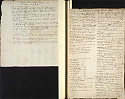
Assyn Edera-Chewlis Coygach and the westerne part of Ross, Distances in Carict and the adjacent shyrs
Click on image to zoom into text


Scroll through text pages
Pagination: 145v-146r
Notes:
From "The cowntrey of Assyn..." to "...being the Inland Cowntrey" also appears on Pont 4 back.
Transcription of text:
Assyn Edera-Chewlis Coygach and the westerne part of Ross
The cowntrey of Assyn is devyded in 4 parts. the first Sliss-cheules, it lyeth upon Chewles-gung. the secund is Etera Viisk, reaching from the river Trallighyr to the river Chireag devyding Assyn from Coygach. the third is Row-stoir wher a great headland shooteth into the sea fornent the yle of Lewis. the fourt is Brae Assyn, being the inland cowntrey.
Be Mr Timothies reconing, betuix Loch Borrowlan from whiche Trallyghyr river falleth it is to the sea 19 myles, at the head of the said Loch west therfra. hard by it beginneth Strockell in Ross.
Avon Hellevin 7 myle long, and falleth in Kerkaid upon Assyn-syd, it hath Loch Meady 3 myls long.
On the northsyd of Trallyghir beginneth Macky his march, ther is also Ard-na-lyn and hard by Quinagg a verie hye hill.
It is 7 myles betuix Kean-loch-Carrown in Coygach and the kirk of Combrich, and it is 4 myles betuix the said Kean-loch and Rossol in Coygach also
It is 7 myl out of C. Ilen Donen to Kean-loch-Carrown
Loch Carron is a bay north fra Kyntail, south of Loch-Ew. the river Carron falleth in it, the head of that river marcheth with Leadgaun, going down to Strath-wrann.
It is 12 myles from Langoll on Cannord (which is a loch hard by be north Loch Breyn, and a River running therein, the strath of which river is called Strath Cannord) and Amad-na-Goulyn in Stra Okell, being almost both alyk east
Bin-Moir-Assyne a very hie hill, neer Trallighyr river and at the head of Straokell hath a kynd of rough Marble and ovirlooketh all the neighbour hills.
Avon Muckernich ryseth sum 8 or 9 myles from the head of Loch Breyn and the kirk of Loch Breyn, it goeth to the eastward and to Garrow-rachon, and falleth in the river Connan, and so in the fyrth of Cromarty a litle from Dingwell.
Distances in Carict and the adjacent shyrs
Girven mouth in Carrik is fra Stinchar mouth north 12m. it is 18m. the first is Girven kirk and toun at the sea on the west syd Nixt is Trochrigy 1m. Pintil 2m. Killochan on the n syd 2m. Bargenie 4m. west syd Brunstoun 1m. Dochorron 1 m. Drimmellen 1m. Bartlennachan 1/2 m Drymmochrin 1/2 m Dalduff 3m. Kirk Michel a kirk 2m. Clencaird 1m. Blaquhan 1/2m. Kirk of Stratoun 1 m.
Dun is the nixt river the mouth of it at the sea on the wet syd fra Girven 8m. at the sea theron is Grinan Brigend 1m. Blairstoun 1m. Achindrene 2m. Monkwood 1m. Cassils 1m. west syd Barbistoun 1m. Keirs 3m. the lenth of that river from the mouth to the loch 14m. the lenth of the loch 6m. the broad 2m. sumtyms less
Millanderdail a litle water it goeth in the sea betuix Girven and Stinchar 4m. fra Ballintrae, upon it at the sea Carletoun Millanderdail 2m up
Troquhain between Girven and Dun 3 myl fra the sea fra Bargeny[?]
Mayboll 6m. fra Ayr 8m. fra Girven 4m. fra the sea
Kyllcheinyee 2m. fra Mayboll just west fra the sea 5m
Baltassan a myl fra Mayboll nordwest
Gadiehorn 2 myl fra Mayboll just norh
Knockdon 3m. nordwest fra Mayboll
Dunduff 4 m. fra Moneboll north west
Betuix Ayr and Lanrik 24m. and Newmils midway
Douglass and Lanrik 8m.
Lanrik and Biggar 4m.
Biggar and peebils 12m.
Crawfurd Lyndsay Biggar 6m.
Crawfurd Jhon and Biggar 8m.
Lowdon Cast. Glasco 12
Lowdon Hamiltoun 13m.
Lowdon Lanrik 13m.
Irwing Lairgs in Cuningham 13m.
Crosregual is fra Maybol 2m. NW fra Baltassan 1/2m to the W therof viz of Baltassen
Kilmars fra Irwing 4m. fra the sea also 4m. it is in Cuningham
Sheilach of Minnok in Galloway at the head of Cree and the west part of Stinchar in Carrik 3 myl
betuix Minnok and the neerest part of Dun river is 6m.
Kyl beginneth at Dun river, it is betuix the mouth of it and the mouth of the river Ayr 2m. it is of lenth 24m. Ayr toun on the south syd with a Bridge
Luggar river falleth in it 8m. above Ayr on the south syd Ayr river runeth for the most part straicht
St Kebets Kirk 4m. up the water on the north syd and 2m fra the water
Achincrue 4m. up the river on the north syd
Sundrim 4m. up the river on the south syd hard upon it
above Sundrim is Goadyart 2 myl on the south syd
above Goadyeart on the water is Previck a m. on the north syd
Interkin above Previk on the north syd a m.
Colsfield is above Interkin 2m. on the river on the north syd
Barskimmin above Colsfield 3m. on the river on the south syd
Kingincleuch above Barskimmin 1m. up the river on the north syd
Bullochmyl nixt on the river up a myl on the north syd
Town Castel and Kirk of Machlin a myl fra Bullochmyl and fra the River a m. north syd
Sorne above Bullochmyl 2m. on the north syd of the river
Smiddieshavis is just aganis Sorne on the uthir syd of the river
Kilmuils croft above Smiddieshawis 1/2 m. on the south syd of the river
Dergean aganis it on the uthir syd of the river
Dadillin 1/2 m. short above Dergean on the north syd of the river
Walwood 4 myl above the former an the north syd
Midwalwood 1/2 myl up on the south syd
Ovirwalwood 1/2 m. up on the same syd
Kems 1 m. up of that same syd
therfra up a myl the Muirkirk a kirk on the northsyd
above that Aishaburn 1 m. on the south syd
above that the spyeslak on the very head of the water
the neerest part of Clyd ther wnto is Lainrik and is distant 8m.
Upon Luggar is Aflek on the north syd a myl above the inver of that water and Ayr water
Ailze yl is fra Ayre 30m. and fra Ardmillan 12m. fra Girven on the west syd, whilk is the neerest land 18m.
nixt Aflek up Luggar is Ochiltrie 2 myl. on the southsyd
nixt is Watersyd on the north syd 1m.
followeth Lochnorries 1/2 m. on the south syd
Nixt is Torringen C. up the water on the south syd 1m.
Town of Cumnok on Luggar 1/2m. on the south syd
Castel of Cumnok 4m. fra the toun standing on the water of Nith, and is in Kyle
Shankstoun up Luggar above Cumnok town 1/4m. south syd
Tempilland above the former 1/2m. on the north syd
Logan on the south syd 1/2m. Up
Continued