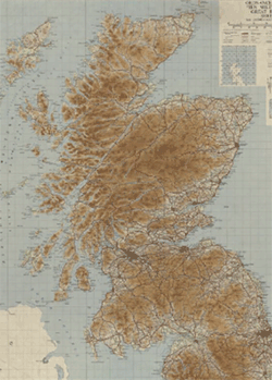
Ordnance Survey, Ten-mile to the Inch Planning Maps of Great Britain, 1940s-1970s
The Ordnance Survey Planning Maps series was initiated during the 1940s, covering the whole of England, Scotland and Wales in two sheets, at a scale of ten miles to the inch, or 1:625,000. Numerous official bodies assisted with providing thematic information, including the Boundary Commissions, the Geological Survey, the Land Utilisation Survey of Great Britain, the Meteorological Office, the Ministry of Agriculture, Fisheries and Food, the Ministry of Town and Country Planning, the Ministry for War Transport, and the Department of Health for Scotland. We have scanned below all our out-of-copyright sheets in this series.
These maps have been divided below into the following categories: Administrative, Air, Electricity, Employment, Gas, General, Geology, Historical, Land Utilisation, Physical, Population, Railways, Rainfall, Roads, Valuation Regions.
Administrative
View sheets:
| Sheet Name |
Sheet Number |
Publication Date |
Shelfmark |
| Great Britain : Administrative areas | North sheet | 1944 | Map.Area.C16(316) |
| Great Britain : Administrative areas | South sheet | 1944 | Map.Area.C16(316) |
| Ordnance Survey ten mile map of Great Britain : administrative areas | North sheet | 1956 | Map.Area.C16(317) |
| Ordnance Survey ten mile map of Great Britain : administrative areas | South sheet | 1956 | Map.Area.C16(317) |
| Ordnance Survey Ten Mile Planning Maps. Administrative Areas Map | Sheet 1 (North) | 1958 | Map.Area.C16(318) |
| Ordnance Survey Ten Mile Planning Maps. Administrative Areas Map | Sheet 2 (South) | 1958 | Map.Area.C16(318) |
| Ordnance Survey ten mile map of Great Britain : administrative areas. | North sheet | 1962 | Map.Area.C16(319) |
| Ordnance Survey ten mile map of Great Britain : administrative areas. | South sheet | 1962 | Map.Area.C16(319) |
| Ordnance Survey ten mile map of Great Britain : administrative areas. | North sheet | 1963 | Map.Area.C16(320) |
| Ordnance Survey ten mile map of Great Britain : administrative areas. | South sheet | 1963 | Map.Area.C16(320) |
| Ordnance Survey 1/625,000 map of Great Britain : administrative areas. | North sheet | 1965 | Map.Area.C16(321) |
| Ordnance Survey 1/625,000 map of Great Britain : administrative areas. | South sheet | 1965 | Map.Area.C16(321) |
| Ordnance Survey 1/625,000 map of Great Britain : administrative areas. | North sheet | 1966 | Map.Area.C16(322) |
| Ordnance Survey 1/625,000 map of Great Britain : administrative areas. | South sheet | 1966 | Map.Area.C16(322) |
| Ordnance Survey 1/625,000 map of Great Britain : administrative areas. | North sheet | 1967 | Map.Area.C16(323) |
| Ordnance Survey 1/625,000 map of Great Britain : administrative areas. | South sheet | 1967 | Map.Area.C16(323) |
| Ordnance Survey 1/625,000 map of Great Britain : administrative areas. | North sheet | 1968 | Map.Area.C16(324) |
| Ordnance Survey 1/625,000 map of Great Britain : administrative areas. | South sheet | 1968 | Map.Area.C16(324) |
| Ordnance Survey 1/625,000 map of Great Britain : administrative areas. | North sheet | 1969 | Map.Area.C16(325) |
| Ordnance Survey 1/625,000 map of Great Britain : administrative areas. | South sheet | 1969 | Map.Area.C16(325) |
| Ordnance Survey : administrative areas. | North sheet | 1970 | Map.Area.C16(326) |
| Ordnance Survey : administrative areas. | South sheet | 1970 | Map.Area.C16(326) |
| Ordnance Survey : administrative areas. | North sheet | 1971 | Map.Area.C16(327) |
| Ordnance Survey : administrative areas. | South sheet | 1971 | Map.Area.C16(327) |
Air
Electricity supply
Employment
Gas supply
General
Geology
Historical
Land use
Physical
Population
View sheets:
| Sheet Name |
Sheet Number |
Publication Date |
Shelfmark |
| Great Britain: population changes, 1931-38 / compiled by the Ministry of Town and Country Planning. | Sheet 2 (South) | 1944 | Map.Area.C16(225) |
| Ordnance Survey Ten Mile Planning Maps. Population Density | Sheet 1 (North) | 1944 | Map.Area.C16(220) |
| Ordnance Survey Ten Mile Planning Maps. Population Density | Sheet 2 (South) | 1944 | Map.Area.C16(220) |
| Great Britain: population of urban areas / compiled by the Ministry of Town and Country Planning. | Sheet 1 (North) | 1945 | Map.Area.C16(218) |
| Great Britain: population of urban areas / compiled by the Ministry of Town and Country Planning. | Sheet 2 (South) | 1945 | Map.Area.C16(218) |
| Ordnance Survey Ten Mile Planning Maps. Population Changes 1931 - 1939 | Sheet 1 (North) | 1948 | Map.Area.C16(226) |
| Ordnance Survey Ten Mile Planning Maps. Population Changes 1931 - 1939 | Sheet 2 (South) | 1948 | Map.Area.C16(226) |
| Great Britain: population, changes by migration 1921-1931 / compiled by the Department of Health for Scotland and the Ministry of Town and Country Planning. | Sheet 1 (North) | 1949 | Map.Area.C16(221) |
| Great Britain: population, changes by migration 1921-1931 / compiled by the Department of Health for Scotland and the Ministry of Town and Country Planning. | Sheet 2 (South) | 1949 | Map.Area.C16(221) |
| Great Britain: population, changes by migration: Scotland 1931-38, England and Wales 1931-39 / compiled by the Department of Health for Scotland and the Ministry of Town and Country Planning. | Sheet 1 (North) | 1949 | Map.Area.C16(222) |
| Great Britain: population, changes by migration: Scotland 1931-38, England and Wales 1931-39 / compiled by the Department of Health for Scotland and the Ministry of Town and Country Planning. | Sheet 2 (South) | 1949 | Map.Area.C16(222) |
| Ordnance Survey Ten Mile Planning Maps. Population Changes 1921 - 1931 | Sheet 1 (North) | 1949 | Map.Area.C16(224) |
| Ordnance Survey Ten Mile Planning Maps. Population Changes 1921 - 1931 | Sheet 2 (South) | 1949 | Map.Area.C16(224) |
| Great Britain: population of urban areas 1951 / compiled by the Department of Health for Scotland and the Ministry of Housing and Local Government. | Sheet 2 (South) | 1954 | Map.Area.C16(219) |
| Great Britain: population, changes by migration: Scotland 1938-47, England Wales 1939-47 / compiled by the Department of Health for Scotland and the Ministry of Housing and Local Government. | Sheet 1 (North) | 1954 | Map.Area.C16(223) |
| Great Britain: population, changes by migration: Scotland 1938-47, England Wales 1939-47 / compiled by the Department of Health for Scotland and the Ministry of Housing and Local Government. | Sheet 2 (South) | 1954 | Map.Area.C16(223) |
| Ordnance Survey Ten Mile Planning Maps. Population Changes 1939 - 1947 | Sheet 1 (North) | 1954 | Map.Area.C16(227) |
| Ordnance Survey Ten Mile Planning Maps. Population Changes 1939 - 1947 | Sheet 2 (South) | 1954 | Map.Area.C16(227) |
| Ordnance Survey Ten Mile Planning Maps. Local Accessibility | Sheet 1 (North) | 1955 | Map.Area.C16(228) |
| Ordnance Survey Ten Mile Planning Maps. Local Accessibility | Sheet 2 (South) | 1955 | Map.Area.C16(228) |
| Great Britain: population of urban areas 1951 / compiled by the Department of Health for Scotland and the Ministry of Housing and Local Government. | Sheet 1 (North) | 1957 | Map.Area.C16(219) |
| Ordnance Survey Ten Mile Planning Maps. Population Density 1951 | Sheet 2 (South) | 1958 | Map.Area.C16(248) |
| Ordnance Survey Ten Mile Planning Maps. Population Density 1951 | Sheet 1 (North) | 1958 | Map.Area.C16(248) |
| Population change, 1951-1961, by wards and civil parishes / compiled and drawn by the Ministry of Housing and Local Government and the Scottish Development Department. | North sheet | 1966 | Map.Area.C16(249) |
| Population change, 1951-1961, by wards and civil parishes / compiled and drawn by the Ministry of Housing and Local Government and the Scottish Development Department. | South sheet | 1966 | Map.Area.C16(249) |
Railways
Rainfall
Roads
Valuation Regions