Military Maps of Scotland (18th century)
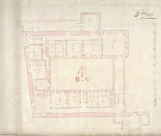
| Title: | Plan of the Governor's appartments at Stirling Castle |
| Description: | 1 manuscript map ; 353 x 418 mm. |
| Original Survey: | 1733 |
| Date on Map: | 1733 |
| Placename: | Stirling |
| Parish: | Stirling |
| County: | Stirlingshire |
| Shelfmark: | MS.1649 Z.46/58 |
| Zoom Into Map: | Click on the map to view in greater detail. |
All images © Crown Copyright and © National Library of Scotland