Military Maps of Scotland (18th century)
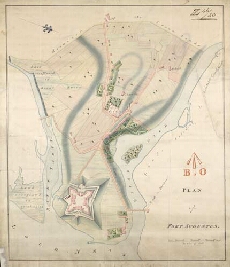
| Title: | Plan of Fort Augustus |
| Description: | 1 manuscript map ; 424 x 358 mm., on sheet, 452 x 389 mm. |
| Placename: | Fort Augustus |
| Parish: | Boleskine and Abertarff |
| County: | Inverness-shire |
| Shelfmark: | MS.1650 Z.46/23 |
| Zoom Into Map: | Click on the map to view in greater detail. |
All images © Crown Copyright and © National Library of Scotland