Military Maps of Scotland (18th century)
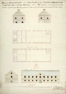
| Title: | Plans, Elevations, and Sections of the North Ordnance Store-House at Fort George with a Design for converting part of the North end of the said Building into an Hospital, for the better accomodation of the Troops |
| Name: | Rudyard, Henry (Engineer) |
| Description: | 1 manuscript map ; 692 x 492 mm. |
| Date on Map: | ca. 1780s |
| Placename: | Fort George (Ardersier) |
| Parish: | Ardersier |
| County: | Inverness-shire |
| Shelfmark: | MS.1649 Z.03/50 |
| Zoom Into Map: | Click on the map to view in greater detail. |
All images © Crown Copyright and © National Library of Scotland