Military Maps of Scotland (18th century)
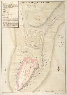
| Title: | Plan of the Castle of Blackness [in 1690]; [copied in] 1741 |
| Name: | Dury, Theodore (Engineer) |
| Description: | 1 manuscript map ; 668 x 454 mm., on sheet, 715 x 512 mm. |
| Original Survey: | [1741] |
| Date on Map: | [1741] |
| Placename: | Blackness Castle |
| Parish: | Carriden |
| County: | Linlithgowshire/West Lothian |
| Shelfmark: | MS.1647 Z.02/75b |
| Zoom Into Map: | Click on the map to view in greater detail. |
All images © Crown Copyright and © National Library of Scotland