Military Maps of Scotland (18th century)
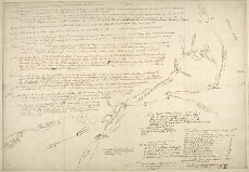
| Title: | [Sketch and description of the proposed Roads from Callander and Loch Tay to Fort William and Appin including details of mileage and of inns] |
| Name: | [Wade, George (Engineer)] |
| Description: | 1 manuscript map ; 528 x 757 mm. |
| Original Survey: | [ca. 1724-45?] |
| Date on Map: | [ca. 1724-45?] |
| County: | Perthshire, Inverness-shire, Argyllshire |
| Shelfmark: | Acc.10497 Wade.58m |
| Zoom Into Map: | Click on the map to view in greater detail. |
All images © National Library of Scotland