Military Maps of Scotland (18th century)
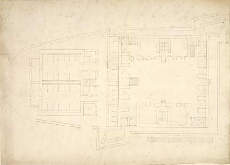
| Title: | [Plan of Fort] |
| Name: | [Wade, George (Engineer)] |
| Description: | 1 manuscript map ; 379 x 524 mm., on sheet, 455 x 688 mm. |
| Original Survey: | [ca. 1724-45?] |
| Date on Map: | [ca. 1724-45?] |
| Placename: | Fort Augustus? |
| County: | Inverness-shire |
| Shelfmark: | Acc.10497 Wade.58k |
| Zoom Into Map: | Click on the map to view in greater detail. |
All images © National Library of Scotland