Military Maps of Scotland (18th century)
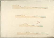
| Title: | Fort George [North Britain] No.5; Section thro' the Line i.k; Section thro' the Line l.m; Section thro' the Line n.o; Section thro' the Line p.q |
| Name: | Skinner, William (Engineer) Tarrant, Charles (Draughtsman) |
| Description: | 1 manuscript map ; 503 x 716 mm., on sheet, 539 x 737 mm. |
| Original Survey: | 1752 |
| Date on Map: | 1752 |
| Placename: | Fort George (Ardersier) |
| Parish: | Ardersier |
| County: | Inverness-shire |
| Shelfmark: | MS.1646 Z.02/46a |
| Zoom Into Map: | Click on the map to view in greater detail. |
All images © Crown Copyright and © National Library of Scotland