Military Maps of Scotland (18th century)
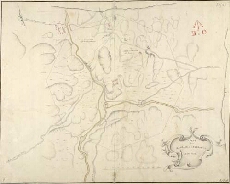
| Title: | A Plan of the Barrack at Inversnait Anno 1719 [copy] |
| Name: | Jelfe, Andrews (Architect) |
| Description: | 1 manuscript map ; 460 x 583 mm., on sheet, 476 x 597 mm. |
| Original Survey: | 1719 |
| Date on Map: | 1719 |
| Placename: | Inversnaid |
| Parish: | Buchanan |
| County: | Stirlingshire |
| Shelfmark: | MS.1648 Z.03/16c |
| Zoom Into Map: | Click on the map to view in greater detail. |
All images © Crown Copyright and © National Library of Scotland