Estate Maps, 1750s-1900s
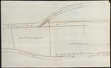

| Title: | Plan of field at Gallowhill [Curriestanes, Troqueer] showing the old and new roads from Galloway to Dumfries |
| Imprint: | 1812 |
| Pagination: | 1 manuscript map; 23 x 37 cm. |
| Shelfmark: | GGD429/1 |
| Notes: | Courtesy of the Ewart Library through the Dumfries Archival Mapping Project. |
| Zoom Into Map: | Click on the map to view in greater detail. |