John Kirk - Survey of farms in Golspie and Loth parishes, Sutherland, ca. 1772
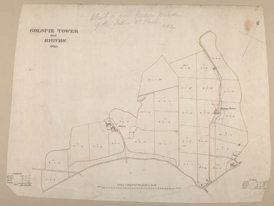
| Title: | Golspie Tower and Rhives (Loose Sheet) |
| Imprint: | Surveyed: ca. 1829 |
| Pagination: | 1 map ; 35.3 x 48 cm. |
| Shelfmark: | Dep.313/3581 |
| Notes: | We are very grateful to Sutherland Estates for permission to display this map on our website. Sutherland Estate mapping home page. |
| Volume Title: | From: Volume of 13 plans of Golspie and environs, 1767-1829 |
| Zoom Into Map: | Click on the map to view in greater detail. |