John Kirk - Survey of farms in Golspie and Loth parishes, Sutherland, ca. 1772
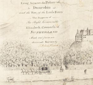
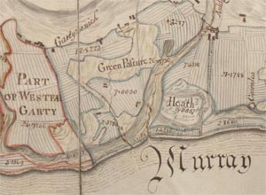
These two attractive and detailed volumes of manuscript estate plans, are our earliest detailed maps of these two east coast parishes in Sutherland. They cover the arable coastal strip from Golspie in the south, through Brora, to what became the fishing village of Helmsdale in the north. For the Sutherland Estate owners, this included some of their richest arable land, as well as the home farm and policies around Dunrobin Castle. The plans were largely drafted by the estate surveyor, John Kirk, in 1771-3, but they also include a plan by John Home, who completed Kirk's work before surveying Assynt in 1774.
Sutherland Estates

When Lady Strathnaver died in 1766, clolsely followed by her grandson (Earl William, the nominal owner) in 1767, ownership of the Sutherland estates passed to the 1-year old Elizabeth, Duchess-Countess of Sutherland. During her minority, the Sutherland Tutors controlled estate business, and through Captain James Sutherland, new surveys were organised of the estates.
Agricultural Improvement
Along this eastern sill of Sutherland, the more extensive land and better climate had allowed the most progress in agricultural 'improvement' in the county, with consolidated farm holdings, enclosed fields and new crops. In Golspie parish by the 1790s, there were 1,000 acres of arable land, over half in farms of more than 50 acres, and slightly less than half in farms of 100 acres or more. Most of the largest farms were enclosed, and in contrast to the predominant oats and barley elsewhere, there were 70 acres of turnips, 140 of pease, and 150 of sown grass. In the parish of Loth, according to the Statistical Account, 'all the tacksmen and tenants have one half of their arable land in bear, and the other half in oats and pease'. Kirk's plans clearly quantify and locate the arable ground, plantings of trees, and 'improveable pasture'. In 1791-2, there were over 300 oxen in the parish (for ploughing - horses were still used infrequently), 200 milk cows, and 1500-2000 sheep. Nevertheless, communications were poor, there were virtually no manufactures, relatively little fishing, and a steady emigration to the south and overseas.
John Kirk

The Edinburgh-based land surveyor, John Kirk, was appointed by the Sutherland Tutors in July 1771 to survey the east coast parishes of Loth and Golspie. By the end of the season, most of the arable land had apparently been surveyed, and Kirk returned the following year to continue. These were particularly difficult years, with crop failures and hard winters, and Sutherland Estates distributed 6000 bolls of victual amongst the tenants to reduce hardship. Between July 1771 and May 1773, Kirk was paid a total of £60 in six instalments for his work, and he was ordered to survey Assynt in 1772. His death was recorded by the Sutherland Tutors in November 1773, and John Home ordered to continue his work (Dep.313/724-5). John Home's fine plan of Golspie of the lands from Little Ferry to Dunrobin completes Kirk's main survey of Golspie parish, although there are two later plans of Rhives dating from the 1820s in the same volume by an unknown surveyor.
