Admiralty Charts of Scotland, 1795-1904
| Name: | Great Britain. Hydrographic Office |
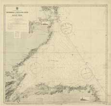
| Title: | Peterhead to Pentland Firth, Incl. the Moray Firth |
| Imprint: | [London: Hydrographic Office], revised to Aug 1942 |
| Pagination: | 1 map; 87 x 83 cm. |
| Shelfmark: | Admiralty Chart 115 |
| Notes: | View georeferenced chart |
| Zoom Into Map: | Click on the map to view in greater detail. |