Admiralty Charts of Scotland, 1795-1904
| Name: | Great Britain. Hydrographic Office |
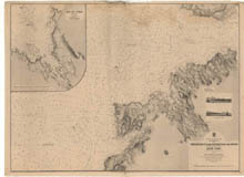
| Title: | Treshnish Point to the Entrance of the Sound, including an enlarged plan of Loch Cuan |
| Imprint: | London : Hydrographic Office, surveyed 1856, corrections 1864, published 1864. |
| Pagination: | 1 map ; 733 x 1002 mm. |
| Shelfmark: | Admiralty Chart 2832 |
| Notes: | View georeferenced chart |
| Zoom Into Map: | Click on the map to view in greater detail. |