Admiralty Charts of Scotland, 1795-1904
| Name: | Great Britain. Hydrographic Office |
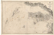
| Title: | Loch Tuadh and the Isles |
| Imprint: | London : Hydrographic Office, surveyed 1857, published 1859. |
| Pagination: | 1 map ; 680 x 1021 mm. |
| Shelfmark: | Admiralty Chart 2652 |
| Notes: | View georeferenced chart |
| Zoom Into Map: | Click on the map to view in greater detail. |